Introduction
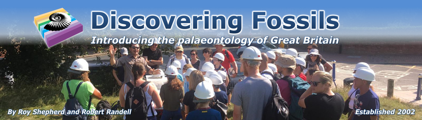
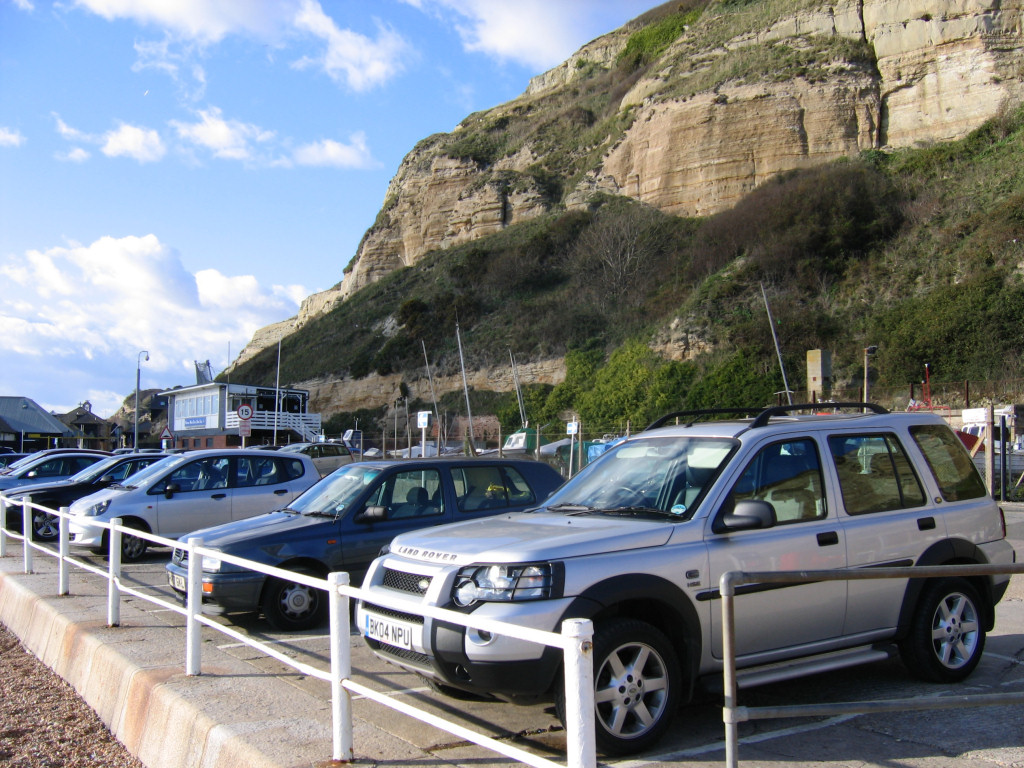
Hastings is a large town (and borough) on the coast of East Sussex in Southern England with a population of over 86,000 people. Immediately east of the town and extending for four miles towards Fairlight are a series of spectacular golden coloured cliffs that tower over 100 metres above sea-level.
In recent centuries many fine fossils have been exposed within the cliffs and foreshore, including the skeletal remains of dinosaurs, pterosaurs and fish, and other creatures and vegetation that inhabited this environment around 140 million years ago (mya).
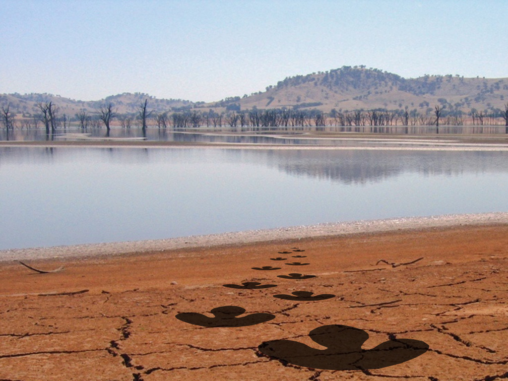
The sandstone rocks and fossils provide evidence of a large lake or lagoon, rich in aquatic and land based life, including several species of herbivorous (plant eating) and carnivorous (meat eating) dinosaurs. Although dinosaur bones are relatively rare the evidence of these reptiles movements can be found more commonly in the form of footprints and casts on the surface of fallen rocks.
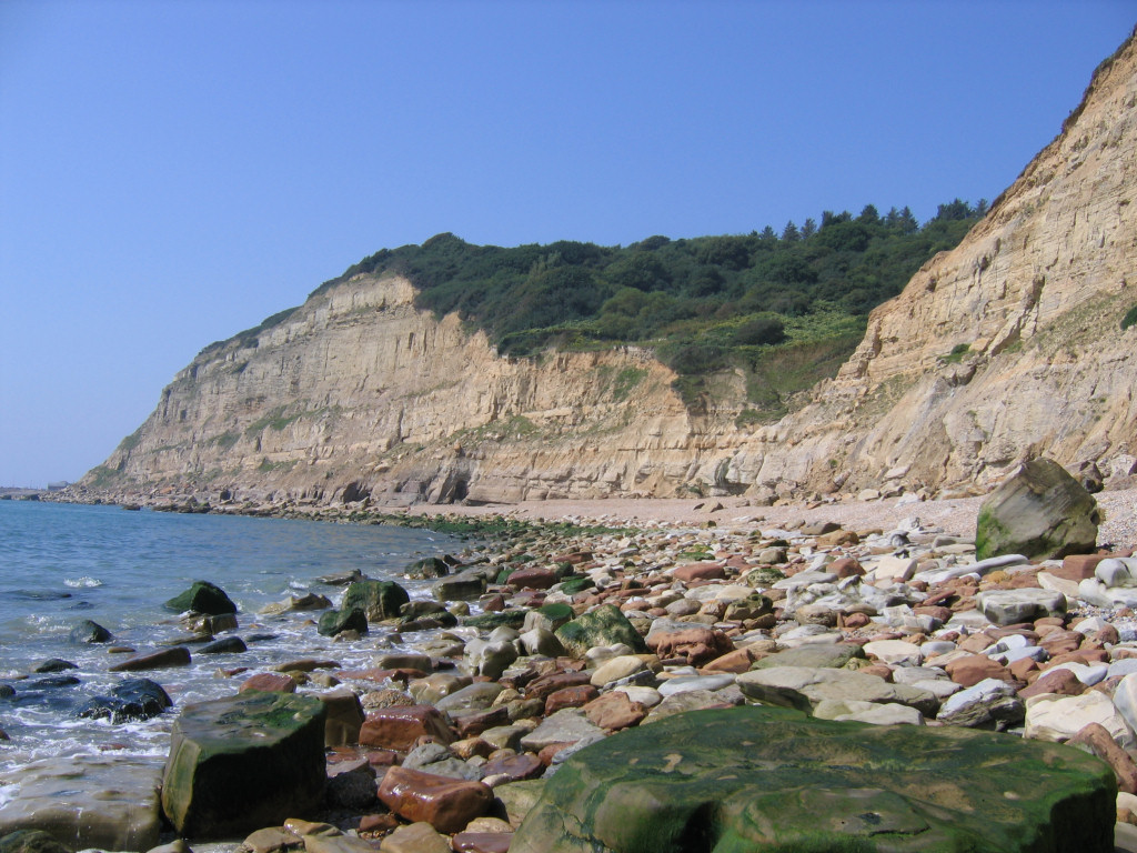
Access to the cliffs and foreshore is made from Rock-a-Nore road, along which ‘pay and display’ parking is available throughout the year (see below). A visit to Hastings is best timed to coincide with a falling tide as much of the foreshore is otherwise submerged beneath the sea, however depending on the height of the high-tide some areas of the backshore may remain accessible.
The geology of Hastings
The sediments exposed in the cliffs and on the foreshore between Hastings and Fairlight in the east date from the Early Cretaceous epoch (Berriasian – Valanginian stages) approximately 143-139 mya. The sand and silt was transported to the area by rivers and streams, and then settled in a large lake/lagoon (predominantly above sea level). At this time Hastings and the rest of Britain were part of the European landmass, located around 40°north of the equator, on the same latitude as the Mediterranean Sea is today.
For much of the Berriasian and Valanginian stages the climate was sub-tropical with seasonal changes in temperature and rainfall. The mostly low-lying land that surrounded the water was home to a rich plant flora, revealed by the abundance of fossilised plant material found throughout the succession. Conifers and related plants were the dominant tree and cycad-like plants were also present (see below). Grasses did not exist during the Cretaceous, instead the ground was covered by the horsetail Equisetites.
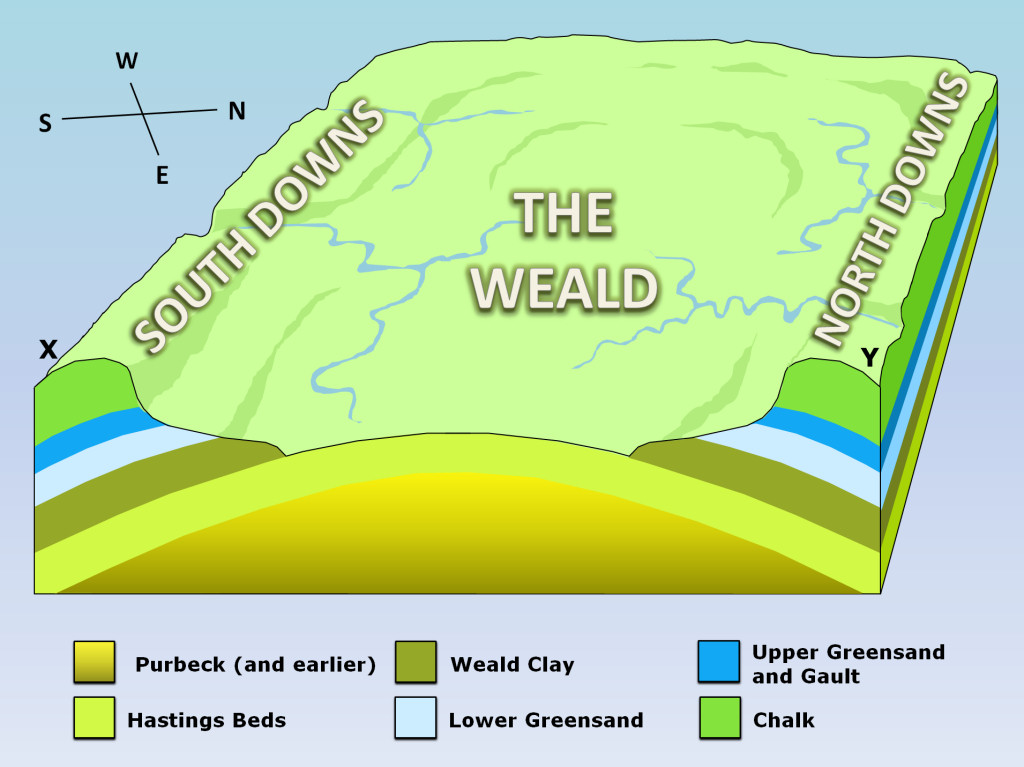
Hastings is part of the Weald Basin, an area of uplifted land that occupies over 4,000 square kilometres of South East England (south of London), between the South and North Downs. The uplift is the result of pressure generated by the European and African continental plates colliding (generating the Alps), a process that took place to the greatest extent 30-25 mya (see Fig.1 and 2 below).
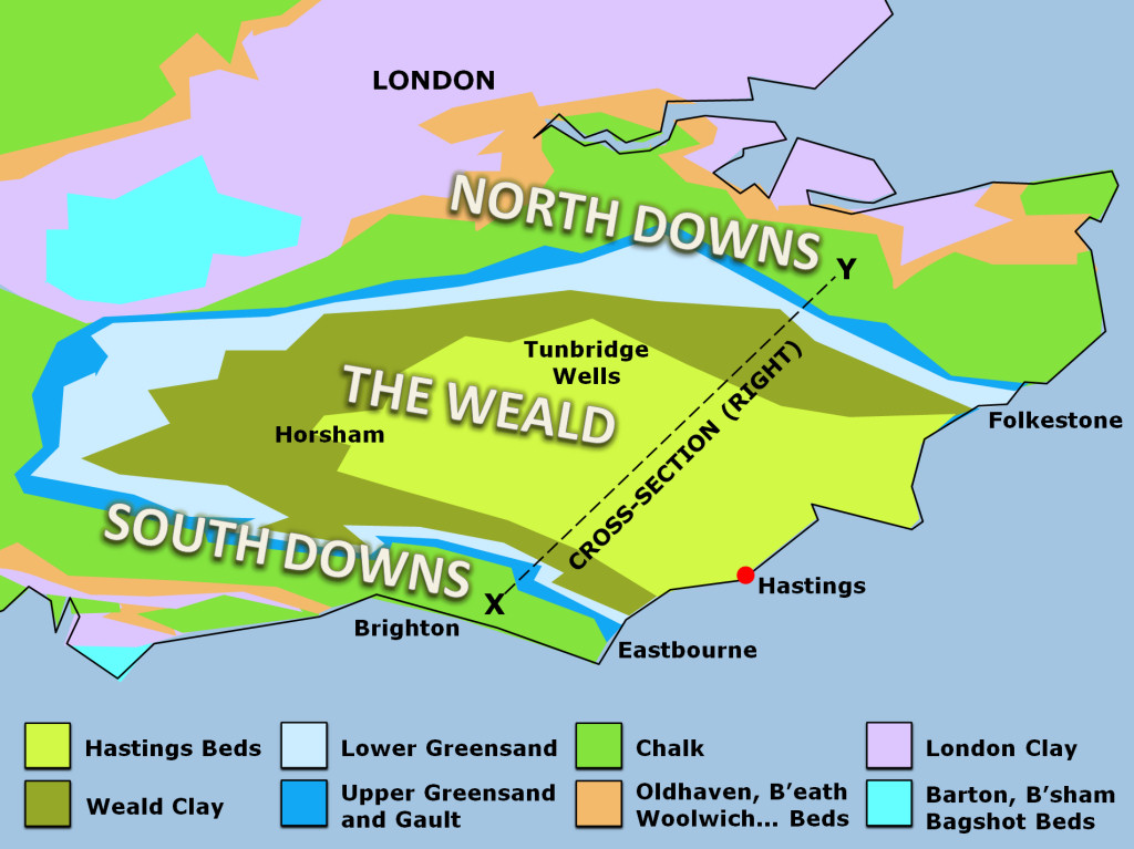
Over time the surface of the uplifted land has been greatly eroded, stripping away the upper (later) layers and exposing the underlying (earlier) sediments. Erosion has occurred at its greatest towards the centre of the anticline where the uplift is at its highest. The process of erosion is the reason why the top of the cliffs at Hastings are not capped by several hundred metres of clays and Chalk in particular.
The sediments exposed between Hastings and Fairlight belong to the Ashdown and Wadhurst Clay formations, and are comprised mostly of alternating layers of sandstones, siltstones and mudstones. Fig. 3 below provides a summary of the geology between East Hill and Ecclesbourne Glen, including the surface position of the Foul Ness Fault.
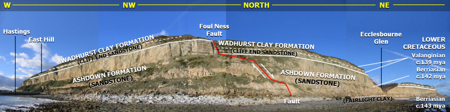
Travelling north-east from Hastings the upper sandstone division of the Ashdown Formation is well exposed in the cliff and on the foreshore. This division, known as the Ashdown Sandstone, measures between 30-50m thick and was originally deposited around 142 mya. The course sandstone (more arenaceous) is thought to reflect a period of high rainfall during which large volumes of sand were eroded from the source rocks and transported into the area.
The Ashdown Formation also encompasses the underlying Fairlight Clay division, a less sandy (more argillaceous) sediment comprised mostly of siltstone and mudstone, dating from c.143 mya. The reduced volume of sandy sediments within the Fairlight Clay is though to reflect a period of reduced rainfall during which erosion of the source rocks was less. The uppermost beds of the Fairlight Clay can be seen in the lower cliff and on the foreshore a short distance beyond the Foul Ness Fault (see Fig.3). Together the two divisions of the Ashdown Formation measure approximately 120m.
Overlying the Ashdown Formation is the Wadhurst Clay Formation, which includes the Cliff End Sandstone at its base; between Hastings and Fairlight approximately 20m of the Wadhurst Clay is exposed. These sediments date from around 139 million years ago and are the earliest exposed in situ along this stretch of coast. The Wadhurst Clay is comprised mostly of grey mudstone with subordinate sandstone and siltstone beds (among others), and represents the marginal area of a lagoon, into which influxes of salt water occurred during a transgression phase.
Travelling east from Hastings the underlying sediments are generally brought to the surface by localised folding, however at the eastern end of Fairlight Cove (approximately 4 miles from Hastings) Haddock’s Reverse Fault brings the overlying Wadhurst Clay Formation to within several meters of the beach level. See the Fairlight page for more information.
Where to look for fossils?
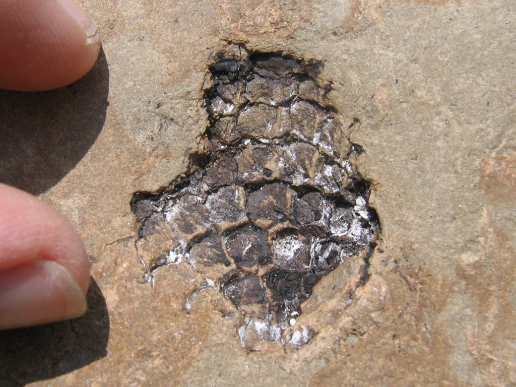
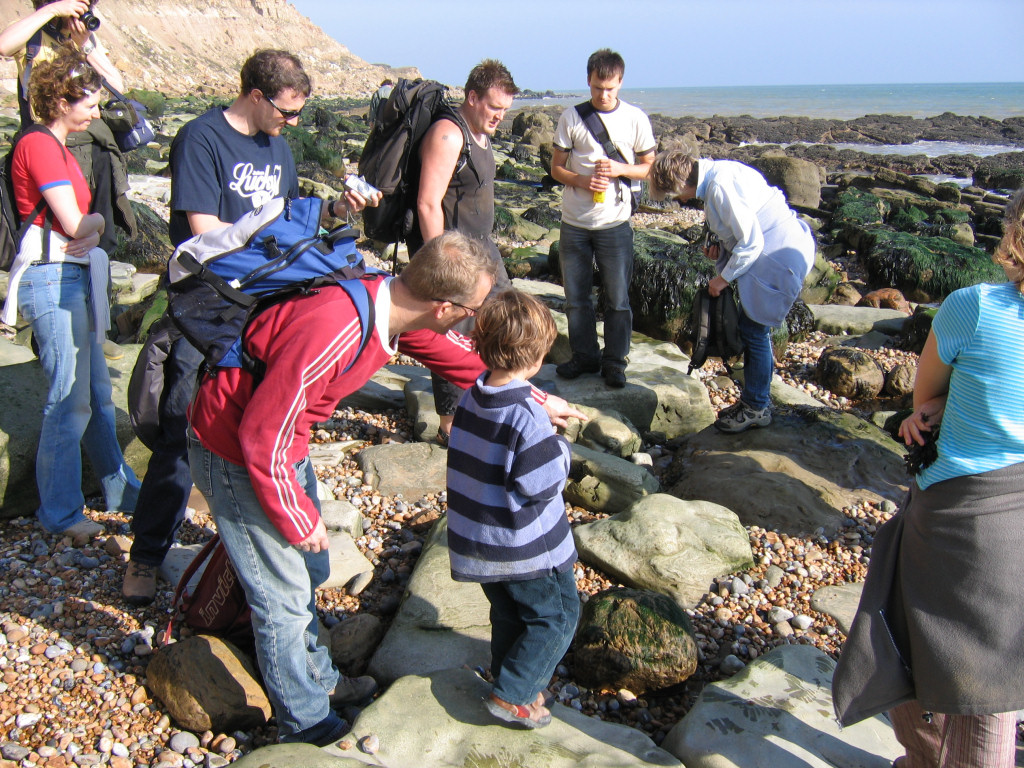
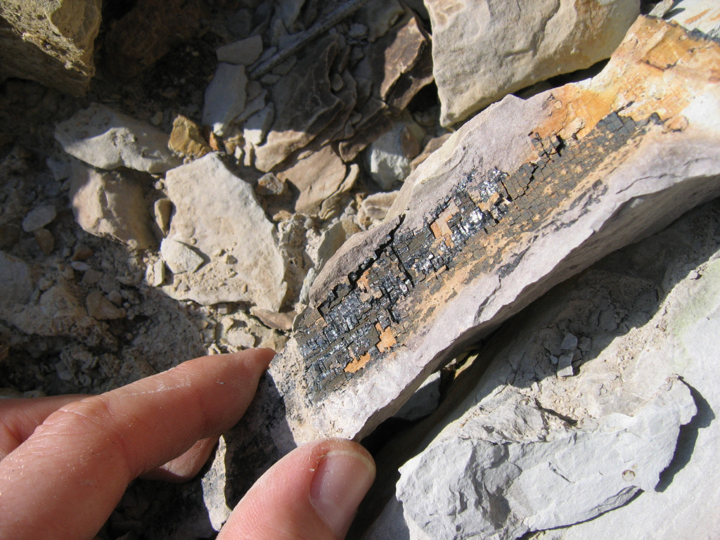
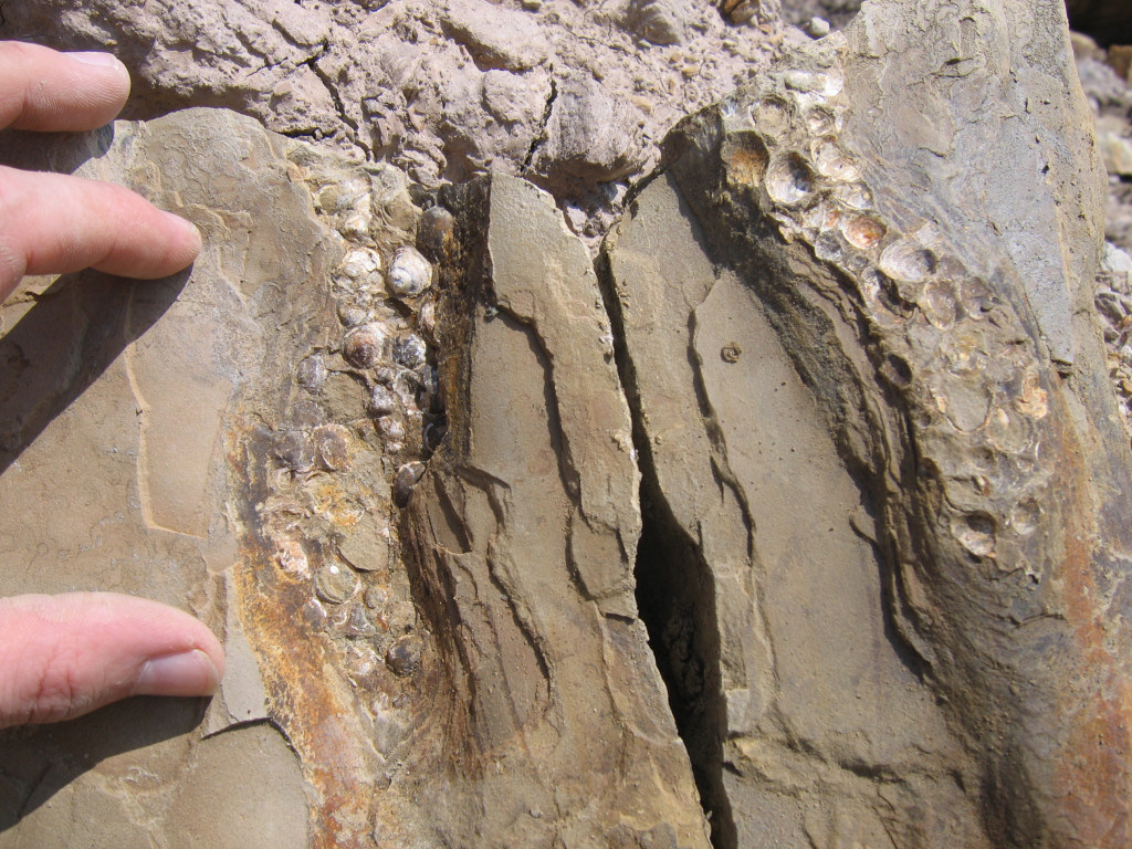
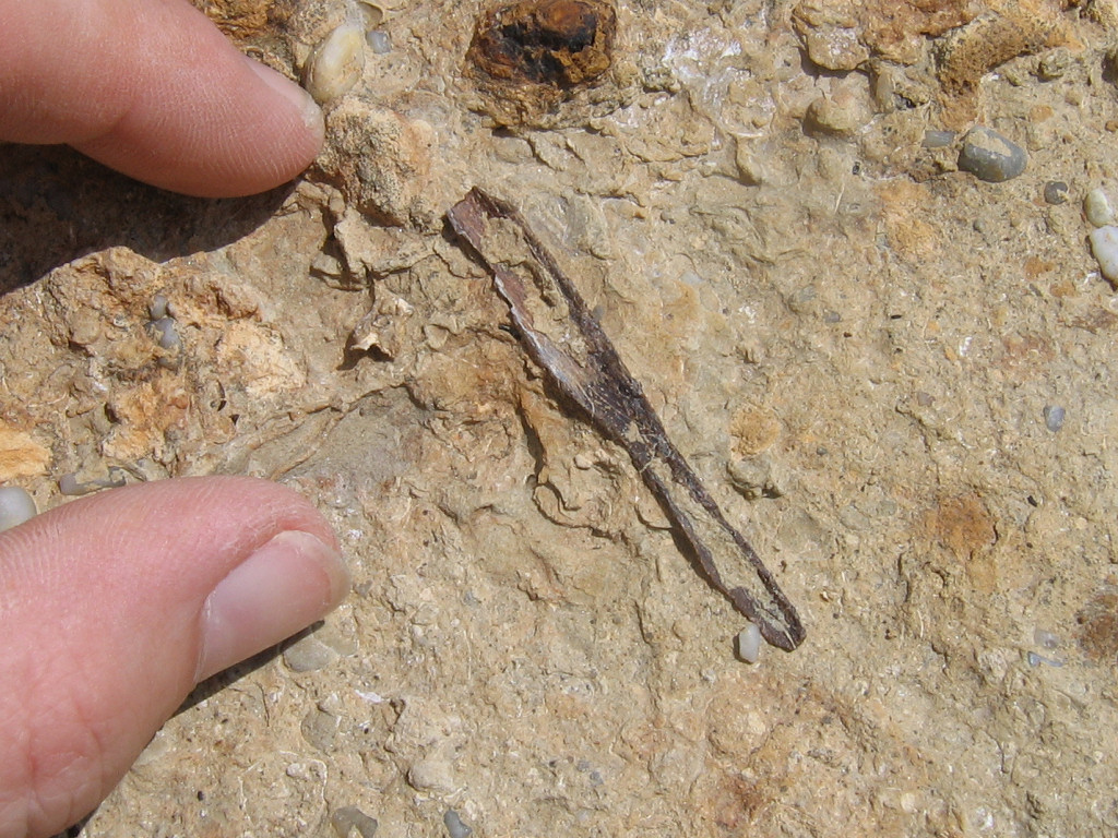
Fossils can be found throughout the fallen rocks and in situ on the foreshore, especially following periods of stormy weather. Although fossils are common, in particular the bivalve Neomiodon, other fossils are less so and it may require several visits to develop a thorough understanding of this prehistoric environment.
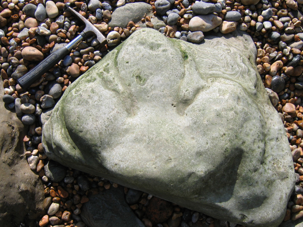
The best place to explore for dinosaur bones and footprint/casts is among the boulders on the foreshore and towards (not directly beneath) the base of the cliff. The cliffs at Hastings are unstable and falling rocks occur frequently throughout the year; it’s always a good idea to keep well clear of the area immediately beneath the cliff face. In recent years a number of large collapses have created vast accumulations of boulders on the beach, and it’s from these that dinosaur footprints can occasionally be found.
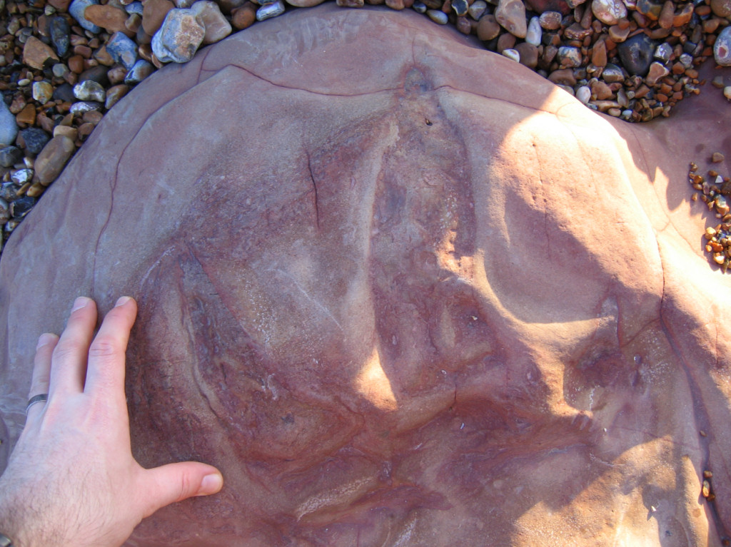
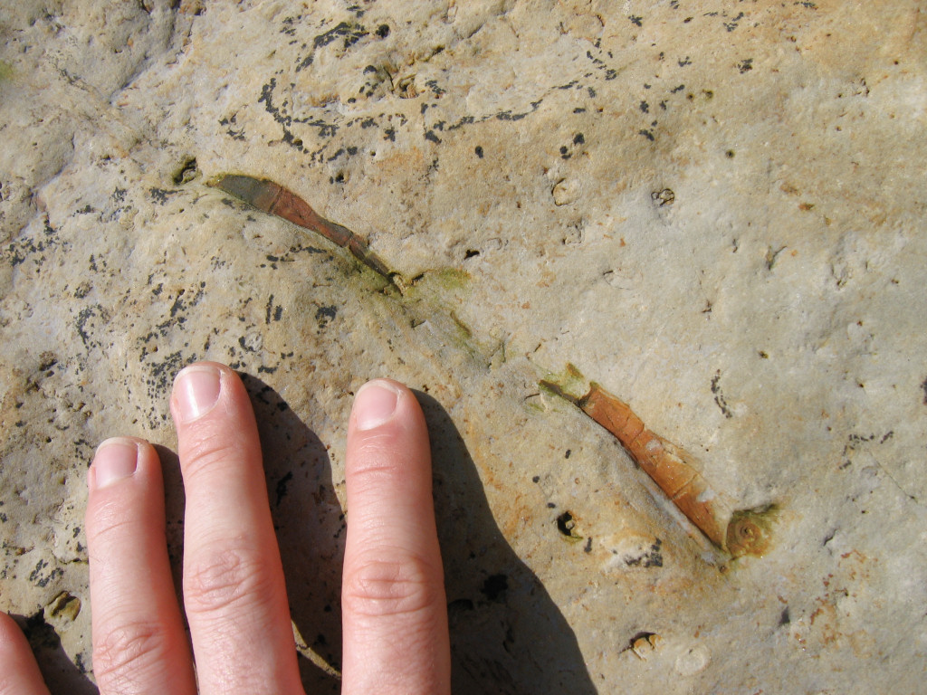
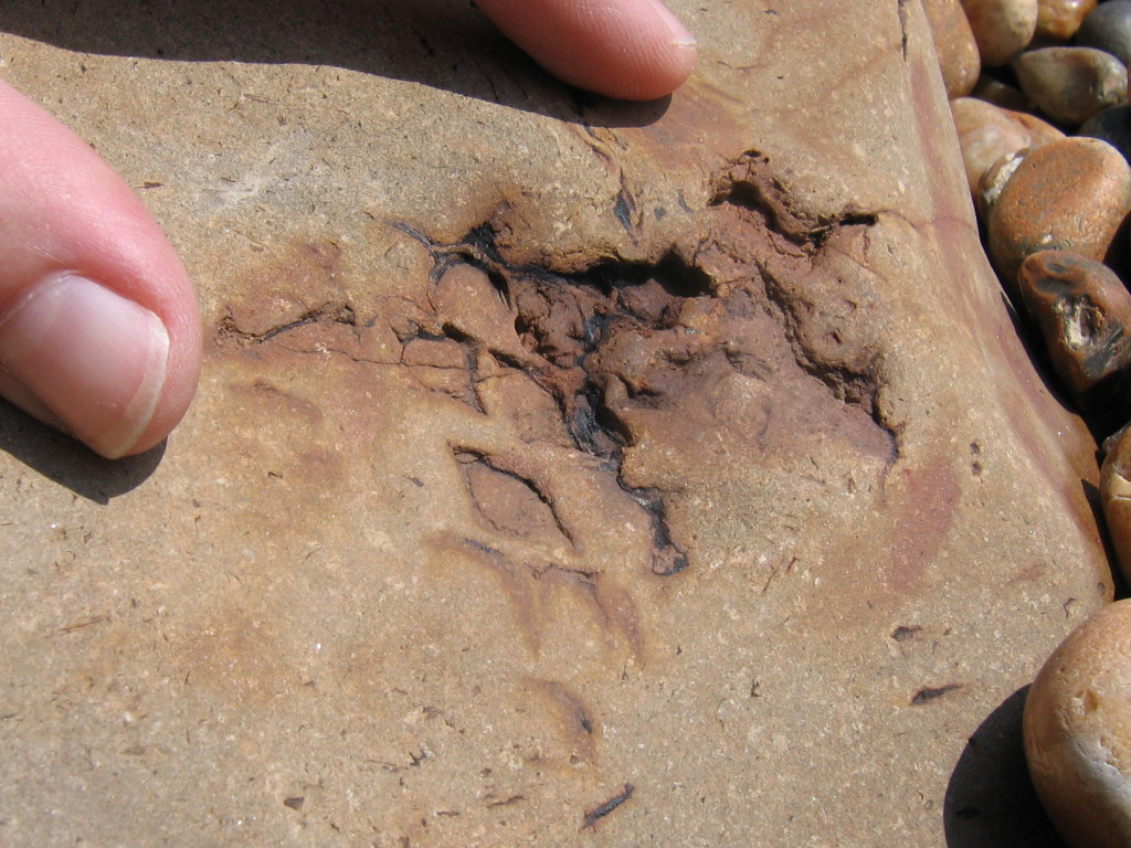
Dinosaur footprints and casts are distinguishable from the surrounding rock by their characteristic three-toed shape. Footprints appear as impressions (indented) on the surface, whereas casts usually protrude above the surrounding rock. For every footprint is a cast, although due to the chaotic nature of cliff collapses they are seldom found in close proximity.
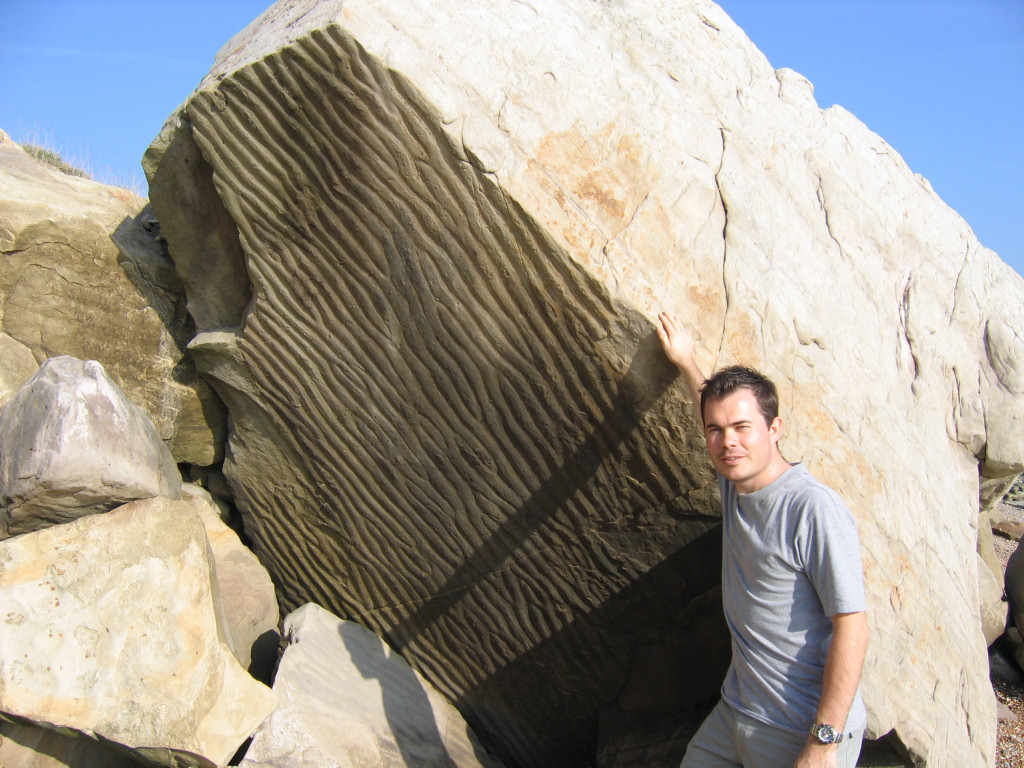
The footprints were originally formed in moist but relatively firm sediment, near to the water’s edge (see Fig. 4 below). Immediately following their formation the sediment dried and hardened in the sun. Soon after, perhaps following a flash-flood, the footprints were buried by additional sediment of a slightly different composite derived from upstream. These subtle differences in composite would later encourage the separation of the rock between the two layers.
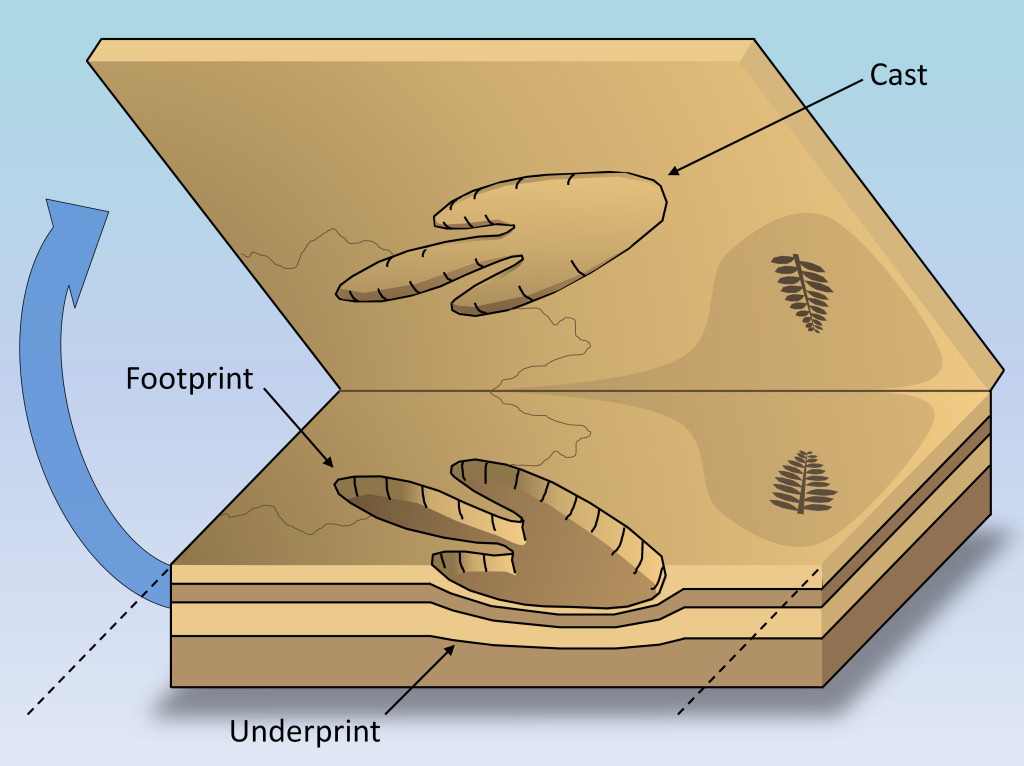
After millions of years the sediment lithified (turned to rock) and natural weaknesses formed along the horizon between the two original layers.
Following exposure in the present day large sections of the cliff collapse onto the beach. As this occurs the two original layers separate along the natural weakness leaving an indented footprint on one surface and a protruding cast on the other (see Fig. 5 above).
In some instances the weakness passes through the cast instead of around it, in which case the two layers may sheer the fossil in half, creating a cross-section on both surfaces. In other instances the cast may become separated from the rock and appear as an isolated boulder.
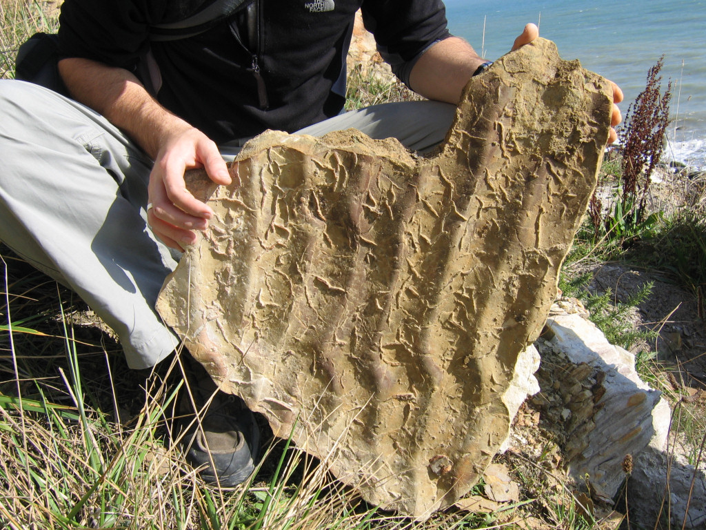
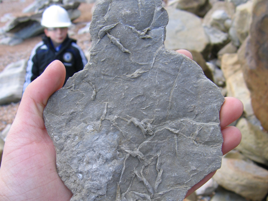
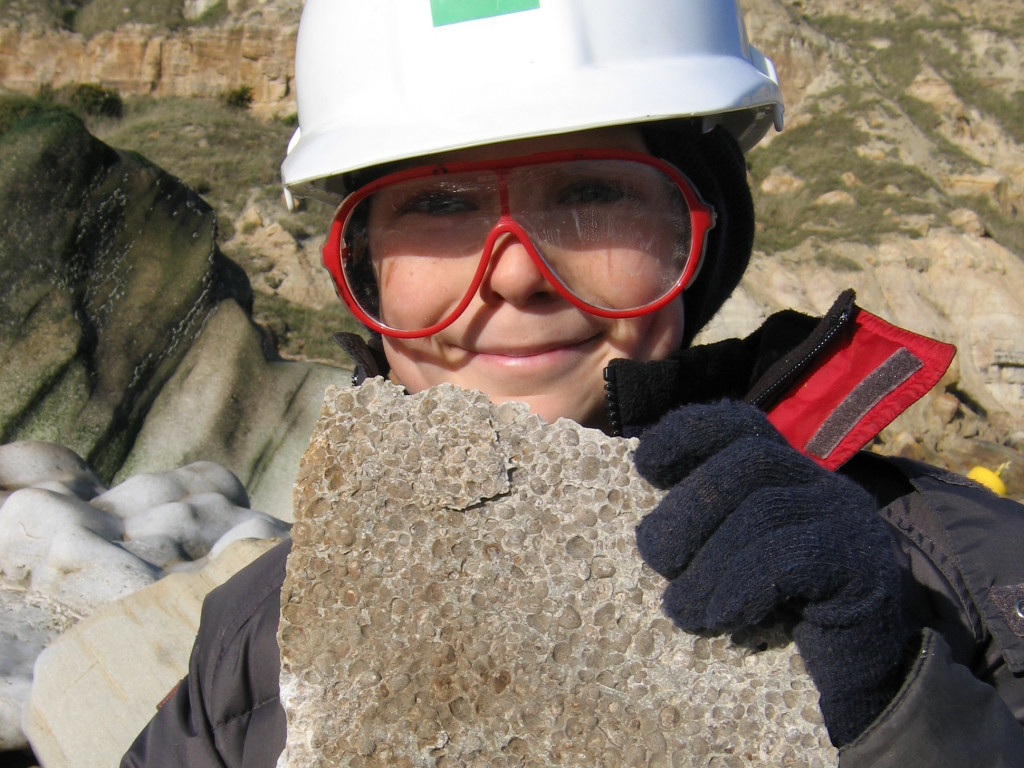
Below are two examples of the most common dinosaur footprints/casts at Hastings. The first (and largest in this instance) is a cast formed by an adult Iguanodon, a herbivorous dinosaur that could reach up to 10m (33ft) from head to tail. Iguanodon featured a narrow head with a strong beak and grinding teeth suitable for grazing on vegetation growing near the lakeside and river banks. It predominantly walked on all four legs, although the larger muscular hind pair carried the greatest load; the lighter front pair featured an additional spike on the first finger used for gathering food and to defend itself. The cast below shows Iguanodon’s characteristic short, wide toes, ideally suited for carrying the dinosaur’s heavy body and tail.
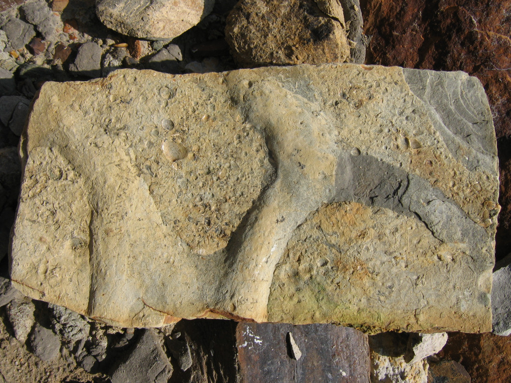
The second footprint shown below belongs to a fast moving carnivorous theropod dinosaur. Unlike Iguanodon, theropod toes were long and pointed with a sharp claw used for improved mobility and clasping prey. The generic features make a precise identification impossible, however for the purposes of this page the footprints are attributed to Baryonyx.
In adulthood Baryonyx was a formidable predator, standing on two powerful rear legs and measuring up to 10m (33ft) from head to tail. These dinosaurs featured a relatively narrow head with long jaws equipped with an arsenal of teeth (similar to a crocodile) ideal for predating upon fish and possibly Iguanodon too. Baryonyx was also equipped with a large claw at the end of each forelimb, most probably used to prevent prey from escaping.
There are usually several footprints to be found at any one time, however for much of the year they may be buried beneath shingle and difficult to locate without prior knowledge of the area. As always, patience and persistence are the key to success.
As with all coastal locations, a fossil hunting trip is best timed to coincide with a falling or low-tide. For a relatively low one-off cost we recommend the use of Neptune Tides software, which provides future tidal information around the UK click here. Alternatively a free short range forecast covering the next 7 days is available on the BBC website click here.
What fossils might you find?
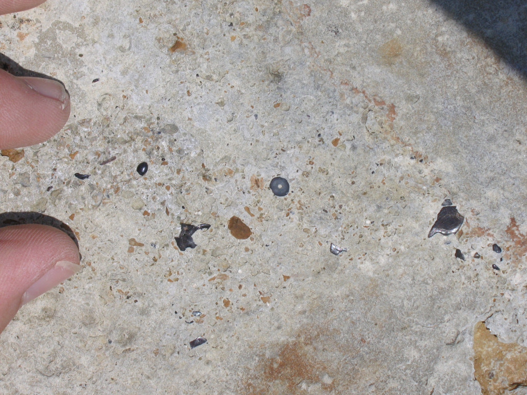
Below are a selection of some of the fossils you may encounter during a visit to Hastings. These specimens were observed or collected during several visits and are not representative of the volume observed during a typical day.

References: Population statistics from www.wikipedia.org; The Complete Illustrated Encyclopedia of Dinosaurs and Prehistoric Creatures, Dougal Dixon; An Overview of Dinosaur Tracking, www.paleo.cc/paluxy/ovrdino.htm; Geology and Fossils of the Hastings area, Ken Brooks; Geological Conservation Review Series, Fossil Reptiles of Great Britain; A Dynamic Stratigraphy of the British Isles, R.Anderton; A Geologic Time Scale 2004, by F. Gradstein, J. Ogg and A. Smith; British Geological Survey, solid geology map; Geology and Sedimentology of the Wealden AONBs, C.Dibden; The Geology of Britain an Introduction, P.Toghill.